In the summer of 2015, we drove from our home in northern Alberta, Canada to "The South", a round trip of over 9000 miles, during which we passed through 19 states. Some of this amazing 25 day road trip was taken up by regular site seeing, becoming reacquainted with old friends, and attending family reunions. However, we also visited parts of Georgia and Alabama, for research purposes and to do our best to find some of the places that Isaac Brewer (1763-1852) once lived, as well as Missouri and Kansas, where some of his descendants ended up. The following are some photos and explanations of the stops that we made. It is my hope that this will aid other relatives in finding these important locations, and walking where our ancestors walked, so to speak.
Terms of Use: All of the photos shown below were taken by my husband or I, and may be shared and posted on your own genealogy websites or online family tree without permission, so long as you source them by linking back to this page.
Georgia
Though Isaac was born in the Creek and Cherokee Nation, in what later became Wilkes County, Georgia, he grew up mostly in the vicinity of the Haw River in North Carolina. In the early 1790's he moved back to Georgia, as a young man. Initially, out of necessity, he lived in a fort, as did all residents of the area who were not under arms. The reason for this was that the region was then the frontier, and there were still conflicts with the Indians who lived on the other side of the Oconee River.
Cedar Shoals Fort (destroyed)
 |
| Entrance to the River Walk |
Directions to site: In Athens, Georgia take Broad Street / Hwy 78 down the hill into the Oconee River valley and park behind Mama's Boy Restaurant. Back there is the entrance to the well maintained walking trails along the river.
Isaac Brewer, in his Revolutionary War pension file, referred to Cedar Shoals as a fort, though it may have been more of a trading settlement with some sort of fortified structure, rather than an officially recognized military fort. This settlement emerged in the red clay hills at the base of the Blue Ridge Mountains, where an old Indian trail forded the Oconee River. Note that "shoals" are sand or gravel bars. In this case, Cedar Shoals, as those early frontiersmen called this spot, was a section of rocky rapids near some cedar trees, shallow enough to allow wildlife and people to cross the river. The trail at this crossing began as a game trail, which the Indians and then white settlers adopted.
As a whole, the early citizens of this region were said to be rough, rowdy, brave, curious, and hospitable. They were also often illiterate and not particularly religious, given that many of them had been raised in other regions that were similarly remote and far removed from the older colonial settlements; schools and preachers were few and far between. Profanity was such an issue among the residents that, in 1786, laws were passed which allowed for the imposing on fines for such behavior. When peaceful times allowed, they engaged in a variety of common means of frontier entertainment, such as log-rolling, gander-pulling, heavy drinking and card playing. When a dispute arose, particularly among the poor,
gouging ➚ was the choice means of resolving the issue and defending one's honor. Whether Isaac ever took part in any of these proceedings, I cannot say, but it is interesting to know what types of people with whom he likely interacted while living in frontier Georgia. Of course, militia musters were also a common occurrence, in which he was certainly involved.
 |
| Modern-day decorative structure |
The fortified structure and old settlement buildings of Cedar Shoals are no longer in existence, and it took a while to find someone who knew where the fort used to be located. All that remains of the old settlement is part of the raceway, which was some sort of stone work, once used to narrow the river for the mill. At the Special Collections building of the University of Georgia, we were told that finding this structure requires a treacherous hike and that, without knowing what to look for, we'd never find it. There are, however, a series of paved paths through the area in which the old fort was once located. Various decorative accents have recently been built along the trails, presumably to commemorate the importance of the area with respect to this early day fortified settlement.
Near the beginning of our hike, we crossed Trail Creek. A local told us that the settlement began here because a spring was discovered, coming from the side of a hill. This water was cleaner and more disease free than that of the larger, murkier Oconee River. The fort may have been close to this creek, for that reason.
 |
| Approaching Trail Creek |
 |
| Trail Creek |
The Oconee River is a very short distance past the creek. Back in the time period during which Isaac was at Cedar Shoals Fort, this river was the boundary between the frontier settlements and the Creek Indian Nation. Though a serene setting now, this region was far from peaceful while he lived there. Much of the forested regions of The South resemble jungle in the density of the undergrowth. One can only imagine what it was like to patrol this river, watching carefully for Indians who might be lurking in the thick trees and brush on the other side, planning thievery or an all-out attack.
 |
| Approaching the North Oconee River from the East |
 |
| Eastern shore of the North Oconee River |
 |
| A spot of high ground on which the fort might have once been located |
It is possible that the old fort was located on this high ground area between the creek, known for its clean, disease free water, and the river, needed for navigation and for monitoring the activity of the Indians. However, this is purely a guess, as we found no marker stating its exact location.
It was near the Cedar Shoals Fort that Isaac saved a young woman from death at the hand of an Indian brave in about 1791. His narrative told of a time when families lived at forts, except for a few who were armed well enough to defend themselves. While living at the fort, shortly after moving to this area, he took his gun and walked alone "a short mile" from the fort. Perhaps, with the possibly crowded conditions, he needed to get some air. Suddenly a woman from one of those outlying farms ran past him yelling, "Indian!" and then she fainted. Isaac spotted an Indian brave, with a gun trained on the woman, presumably intending to kill her. Isaac, who was described by his brother as "expert with a gun" from a very young age, raised his own firearm and shot the Indian before the brave could even pull his trigger.
Several other Indians came into view and Isaac yelled, "Come on, boys! Come on!" and, in that way, scared the Indians into thinking he had a group of men with him. Others from the fort heard the commotion and came to his aid, and the remaining Indians were shot and killed. Isaac then carried the poor woman to the fort and "saw to it that she was nursed of her fright". So this is some of the background of what Isaac Brewer experienced in this very area. Perhaps, in touring this site, we even walked where he walked that day!
Rock Landing Garrison and Fort Fidius (destroyed)
Directions to site: Enter Milledgeville, Baldwin County, Georgia on Highway 22/24. The marker is located at the junction of this highway and Kings Road, within very easy walking distance of the Oconee River.
Unfortunately, I didn't read the signs carefully enough, marking the locations of
Rock Landing and Fort Fidius➚. Thus, we were within 4 and 5 miles of the approximate original locations and didn't realize it. We were also in a hurry, as we'd spent a lot of extra time doing research and taking pictures. What showed as being a four hour loop from Atlanta ended up taking us 13 hours. Don't make the same mistake we did! Get closer to the locations of these old forts by continuing down Kings Road for the designated distances!
 |
Rock Landing Garrison marker
Actual location was about 5 miles down Kings Road from here |
|
 |
Fort Fidius marker
Actual location was about 4 miles down Kings Road from here |
|
 |
| Scene behind the above two signs |
Across Highway 22/24 from the above marker signs are the Milledgeville and Oconee River signs. Milledgeville was surveyed in 1803 and was the Georgia state capital by the end of 1804. Thus, this settlement was not in existence when Isaac lived at Fort Fidius in the 1790's, but I have included this photo to aid others in finding the marker signs, and also for the sake of completeness and context.
 |
| Oconee River on the north side of the bridge, across the highway and then west very slightly from the fort marker signs |
Notice that the river is much clearer and less stagnant in appearance than it was in Athens. Between Athens and Milledgeville the Middle and North Oconee Rivers converge to form the Oconee. It later merges with the Ocmulgee River to form the larger Altamaha River, about a two hour drive to the south.
Though the above photo is taken facing northward, the river would still be consistent in size and appearance a few miles to the south, where Rock Landing Garrison and Fort Fidius once stood. I believe that Isaac Brewer would have lived at the Rock Landing Garrison (Federal Town) from about 1792 to 1793. During this time there was a drought, causing a shortage of corn that led to an increase of conflicts with hungry Indians. Problems with severe illnesses at the garrison caused the fort location to be moved to Fort Fidius, where Isaac likely was stationed from about 1793 to 1797. After this, soldiers were moved from Fort Fidius to the newly built Fort Wilkinson, across on the western side of the Oconee River. I don't think Isaac was every stationed at Fort Wilkinson.
It would have been during his stay at Fort Fidius that he was an Indian spy along the Oconee River. These courageous spies, often on horseback, would sneak across the river onto Indian lands to see what the Indians were up to, and then report any suspicious behavior. In order to conceal their location, they were not allowed campfires. It was understood that they would shoot any Indian that dared cross the line onto the east side of the river, Indian lands being on the west side.
This is likely the area in which Isaac was married ca. 1793, possibly in Montpelier which was established that year 1/2 mile from Fort Fidius, and maybe specifically in the Montpelier Methodist/Baptist Church. Jacob Fletcher Brewer was born in Hancock County ca. 1794, and he was quite possibly Isaac's son. Another man who was likely Isaac's son, Nathan Brewer, was also born in Georgia, probably in the same area, ca. 1795. Note that Fort Fidius was in Hancock County until part of its lands were lost to Baldwin County.
|
|
|
 |
| Some pasture land in Hancock County |
|
 |
| Red Georgia clay in Hancock County |
|
|
|
 |
| Baldwin County |
|
In about 1797, Isaac was able to rest from soldiering for a short while. By roughly 1798 he was fighting again, this time in nearby Washington County. It was there, at a crossing of the Oconee River that was called Sand Bar, about 15 miles east of Sandersville Trading Post, that Isaac was stabbed in the left hand and left thigh by Indians during a skirmish.
He moved to Warren County in about 1798, in the vicinity of the Ogeechee River. There he enlisted with the Warren County Militia to go against the Seminoles in Apalachicola Bay, Florida in 1800. Sometime prior to this, his first wife (name unknown) had passed away and he had married Sarah (maiden name unknown). By 1801 he appeared on the tax records, living near the Ogeechee River and Rocky Comfort Creek, but did not own any land.
Unfortunately, with so many Georgia sites to tour and photograph in one day, I neglected to navigate us through either Washington or Warren Counties, so I have nothing visual to share from those regions.
Jackson County
Soon after that he moved to the "up country" of Jackson County. His daughter, Elizabeth, was later born there in about 1809, and his son, Joseph, in about 1811. You'd never know it from these photos, but a lot of this area is quite hilly. Even if you have no other reason to visit this county, the views are well worth your time. Unfortunately, I don't have any of the old Brewer land deeds from this area, if any exist, so I didn't even attempt to locate any particular parcels of land in Jackson County.
Fort Hawkins (reconstructed)
Directions: We came in from Milledgeville direction on Highway 49. At Macon, Georgia turn left (south) on Maynard Street. The fort is located at Maynard Street and Emery Highway, on the northwest corner of the intersection.
It was also while living in Jackson County that Isaac joined the Silver Grays, when the War of 1812 broke out, and then was hired on as a wagon driver to Fort Hawkins in what was then the frontier of Georgia. Unfortunately, by the time we got to the reconstructed Fort Hawkins in Macon it was very dark, as you can see. With it being after hours, we had to take these pictures through a locked chain link fence and zoom in as best we could. A better photo of the fort can be found
here ➚.
Alabama
Isaac's farm near Silver Run in Talladega County
Directions to NW corner: From Oxford, Alabama proceed down Highway 21, headed southwest toward Munford, for 6.4 miles. Turn left onto Old School Road, then left again onto Henderson Lake Road. Follow that a little ways until it veers right. Instead of continuing there, take a dirt road to the left along a field to where there is a gate across the road. At this point, we were probably about 1/3 of a mile from his property. From this point, following an overgrown cut line, old wagon road, or whatever it is, would probably take you to the property. Looking on Google Earth afterward, it became apparent that this old path through the trees roughly follows the section line that, if it continues far enough, would become the western boundary of Isaac's land.
In about 1819, Isaac moved his family to Eastern Tennessee, and by 1842 he was in Talladega County, Alabama. At this time Isaac was about 79 years old. His days of soldiering were long since concluded, and he spent his time caring and providing for his wife and their unmarried adult daughter, Elizabeth, who would later be described as sickly.
To my knowledge, he remained on the same property for the decade or so that he lived in Alabama, and his obituary states that he died at home. At the time, he was squatting on government land "in the spurs of the mountains", as ownership of the 80 acres plot was not granted until shortly after his death, as a reward for his service in the War of 1812.
The land description was North 1/2, Northwest 1/4, Section 27, Township 17, Range 7. I plotted this on Google Earth to determine the GPS Coordinates and choose a route to drive to it. Unfortunately, without having a quad or horses along, and trespassing on private property or traversing a road that had been closed by the park service, we could not quite reach the boundaries of Isaac's property. However, we were extremely close.
There was a for sale sign on the gate which closed off that cut line to vehicles. I chanced calling the number on the sign, and the man who answered sounded extremely southern and was very nice. He didn't mind if we walked back there to try and find Isaac's land, except he was afraid we would get lost or come upon a rattlesnake, though he assured me there were no larger critters such as mountain lions or bears in that area to pose a threat. Given that we were dressed in running shoes and flip flops - not exactly snake encountering apparel - and the path was overgrown, we chose not to chance it. Plus, we had our children with us and didn't want to put them in danger. So, sadly, we didn't quite reach Isaac's land, but I figure we were within 1/3 mile of it, or thereabouts.
We also tried an alternate route by turning right at the far end of the field. There's another dirt road there that goes way back in the woods, but it seemed like it was taking us in the wrong direction. Still, there might have been a fork up there somewhere that would have taken us closer to the southern portion of Isaac's land. All we'd entered into the GPS were the NW and NE corners, and that road curved kind of SW.
 |
| Decent road that wound back in the hills |
|
 |
| Where we turned around & headed back to Henderson Lake Rd |
|
After these two routes failed, we took the advice of the southerner I talked to on the phone, and backtracked to the junction of Highway 21 and Old School Road, then take Bell Springs Road past the Silver Run Chapel, which he said used to be a school. As he suggested, this road took us way back in the mountains. Unfortunately, partway back in there, the road had been closed by the park service due to bad ruts, and they had pushed a pile of down trees across the road. If we'd had a quad we could have gotten around it and continued on, but all we had was our car. Looking back on it, it's also possible that we could have entered the same road at the south end and come up the other way but, again, the road might have been closed before we could get close enough.
At that point, according to my measurements on Google Earth, we were just under 1/5 mile from the NE corner of Isaac's property, as the crow flies. If we had known that then, we would have just walked the rest of the way. However, we'd have needed internet to know the lay of the land because Bell Springs Road doesn't go to Isaac's land. There appears to be a junction not far from the road closure site, where one would need to veer right, but I can't tell which road joins up with his place. The trees obstruct the image on Google Earth too thoroughly. Our resources were limited and our knowledge insufficient to go traipsing back there with the kids. We plan to return with our quad or else rent one down there, and do some more investigating in the future.
 |
| Junction of Highway 21 and Old School Road |
|
 |
| Silver Run Chapel (used to be a school) |
|
 |
| Road closure sign from the Talladega National Park service |
|
 |
| Trees pushed across to close the road to vehicle traffic |
|
 |
| Rutted road, view toward Isaac's NE corner |
|
 |
| GPS coordinates at the road closure site |
|
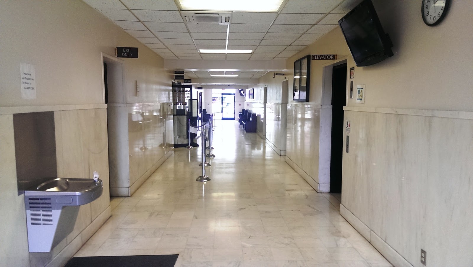
Talladega County Courthouse
It was to this very building that Isaac Brewer traveled in 1846 to declare his service in the Revolutionary War. It was a requirement that those applying for a pension appear in open court, which he did. What a treat to be able to visit this building, that is now well over 175 years old, in which my favorite ancestor entered.
Here's a funny little incident that shows how friendly even strangers are in The South... When I was standing across the street taking the photo of the courthouse, a man drove by in a pickup and yelled, "Cheese!" LOL. That about sums up the bulk of the people we encountered all over the southeastern states on this trip. Stranger after stranger made a point of smiling and visiting with us. A little boy in southern Arkansas is a prime example. I was filling up water bottles from our cooler, when he walked by and asked, "Y'all havin' a good day?" I replied, "Why, yes, I am! How 'bout you?" He answered drearily, "No. Not too good." How sad, and yet how sweet for him to be concerned about me, whom he'd never met, when he was having a rough day himself.
 |
| Talladega sign, flanked by the American & Alabama flags |
|
 |
| Kudzu vines overtaking the powerline |
|
 |
| Talladega County Courthouse in Talladega, Alabama |
|
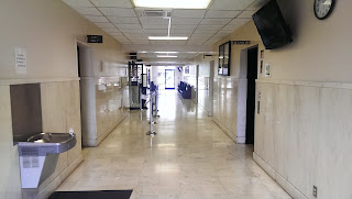 |
| Courthouse's marble entryway |
|
The courthouse went through
various architectural phases ➚ over the years. It is my understanding that the pillars were not yet built onto the front in those early days. A clerk told me that the marble inside the entry is original, but that there was once a grand staircase which led to the courtroom upstairs, where Isaac would have pleaded his case. The staircase was dismantled as part of the remodeling process, and we didn't tour the upper floor. I would think that Isaac, who lived a humble life and never put much value on accumulating worldly goods, would have been awed or maybe even a bit uncomfortable with the building's size and grandeur.
While there we were admitted into an archives room that house many thick, old record books. Handling them was so enthralling. I had hoped to located Isaac's will. However, we didn't find anything pertaining to the Brewer family that I didn't already have. Thus, his last will and testament still remains out of my grasp even though his widow specifically referenced it.
Joseph Brewer's farm south of Munford
We tried to find some Brewer information at the public library in Munford, which is near Silver Run, but didn't find anything. We did, however, have a wonderful visit with the staff, who thought it was quite a novelty to meet people that lived in Canada! Munford seemed to be a rather interesting town actually, with residents who have a sense of humor. Not only was "Obama" added to one of the stop signs, but one yard also sported a hangman's noose in one of its trees. I really wish I would have taken a picture of the hangman's noose, but we couldn't stop every few feet to take pictures or we'd never get anywhere. I was pleased to see a Confederate Battle Flag in one of the yards there as well, suggesting that the residents hold to their southern heritage.
Following our visit to Munford, we headed a short distance south of town to location the land of Joseph Brewer (1811-1874), son of Isaac Brewer. Joseph proved up on this 40 acres parcel in 1851, and later moved to neighboring St. Clair County before 1858, at which time he gained title to another property. I think that his son, James Jasper Brewer, might have taken over the Munford farm, as he was in that area still in 1860.
Directions to Joseph Brewer's land: Take Highway 21 to Cedars Road. Turn south. Hopeful Road is a landmark you might notice after a short ways, but remain on Cedars Road. Soon after the elementary school, Joseph's land is on the left, and would include some of the southern corner of the treed area, and then the field shown below. The land location is SW 1/4, NE 1/4, Section 30, Township 17, Range 7.
 |
| Stop Obama sign (Love it! LOL) |
|
 |
| Joseph Brewer's land, just south of Munford |
|
 |
| Kudzu vines, across Cedars Road from Joseph's land |
|
 |
| GPS coordinates by the western edge of his property |
|
Joseph Brewer's farm in St. Clair County
Our travels next took us to St. Clair County, in search of Joseph's subsequent 40 acre parcel of land. Whether we actually reached his land is debatable. Unfortunately, I didn't write down the GPS coordinates for the corners of his property while we had internet at the hotel, so the last picture is an estimated location of Joseph's old farm. If this isn't it, it's very close. This is also believe to be the vicinity in which he spent the remainder of his time until his death, which might have been ca. 1874.
Direction to Joseph's St. Clair County parcel: Take I 20 to Pell City, then Martin Street South (Highway 53 S). Stay on this highway past Cropwell (where Joseph used to get his mail) to Easonville Road. Turn right (west) on Easonville Road. It will later end and Sweet Apple Road will continue on. At this point there is an intersection with Dry Creek Road. Turn left (south) onto Dry Creek Road. A little ways down this road, Castleberry Hollow Road branches off to the left. Remain on Dry Creek Road. The next land mark is Isbell Road on the right. Joseph's farm is not much farther. Dry Creek Road goes right through the western portion of his property, all the way from top to bottom. His north property line is between the next two residences on the left that are close to the road.
 |
| Dry Creek Road/Sweet Apple Road Junction |
|
 |
| Joseph Brewer' land, or else the general vicinity thereof |
|
Missouri
Halfway and Bolivar in Polk County
Polk County, Missouri is located in the southern part of the state. Jacob Fletcher Brewer Sr (1794-1862/5) and his son, John Wesley Brewer (1816-1863), who were possibly Isaac's son and grandson, migrated there from southern Illinois between 1850 and 1852. Jacob Fletcher Brewer was originally from Hancock County, Georgia, pictures of which are shown earlier on in this post. We did drive through southern Illinois, but we were limited on time, so I really had to pick and choose which areas in which to linger for research purposes. Therefore, I only took general landscape photos in Illinois, and not anything specific to the Brewer family.
Below are a few photos of Polk County, Missouri and the cute, little old settlement of Halfway, where the family got their mail in 1860. Both Jacob and John died here in the 1860's. By 1870, John's widow, Mary America Hunter Brewer, was getting her mail at Bolivar. Both towns were in Benton Township, Polk County, Missouri.
Cape Girardeau
During the War Between the States (aka the Civil War), Edeith "Eda"
Crocker Brewer (1794-1865), wife of Jacob Fletcher Brewer Sr (1794-1862/5), came by horse and wagon to Cape Girardeau, Missouri to pick up her son, John Wesley Brewer. This was in 1863. He had contracted small pox, and some say he was also injured in a battle prior. If this is the case, it could have been the
Battle of Cape Girardeau ➚ or any number of other battles or skirmishes someplace else during that time period.
Smallpox was greatly feared, and the death rate of those infected at that time was almost 40 percent, For more information about smallpox during the war go
here ➚. Perhaps Eda was, in effect, taking her son home to Polk County to die, if he had not already lost done so by the time she arrived. It is sad to imagine the motherly emotions running rampant during her perilous journey. Thankfully she was escorted, aided and protected by a male relative by the name of William Clark. John Wesley Brewer died before August of 1863, at which time his wife applied for a widow's pension.
In all probability, she retrieved him from a building which later become known as the Sherwood-Minton House. It was built in 1846 for a Baptist pastor named Adriel Sherwood. The home is located on a hill at 444 Washington Street, and is now considered to be one of the oldest houses in Cape Girardeau. It has even been said that it is haunted, although some folks that once lived there indicated that they felt more like the spirits of those soldiers were protecting them, rather than wishing to terrorize them. I was unaware of the building's existence at the time of our visit to Cape Girardeau, so I did not see the building first hand.
During the early part of the war it was used as officers' quarters, and I have read that one can still see the gouges from the men's spurs on the staircase. Later it served as a smallpox hospital, and likely housed John Wesley Brewer at the time of his mother's arrival. The part of the house that was used as a military hospital during the war later burned down, but much of the building still stands firm. A nice photo of what remains can be found
here ➚.
Kansas
The following gives some background into why the Brewer family might have moved from Missouri to Kansas temporarily:
During the war some of the people in Missouri, a border state and hotbed of violence, were commanded to leave their properties. This affected those in the western counties of Bates, Cass, Jackson, and Vernon, regardless of whether they sympathized with the Union or the Confederacy. The reason for this harsh command, given 25 Aug 1863 and known as
Order No. 11 ➚, was that it was suspected that some in these areas were aiding the Bushwackers.
Following the
Lawrence Massacre ➚ in Kansas 21 Aug 1863, as well as other violence, the desperate desire was to prevent the Bushwackers and Jayhawkers from finding additional resources in Missouri, which might aid them in continuing to raid. Thus, civilian hay and grain would be gathered by Union troops, recorded, and held at military outposts. Any not hauled by September 9th would be destroyed. This gave the folks in these area only a few days to pack their belongings into wagons and evacuate the area completely. I would suspect that many of them were widows, women with children, and older men, as most of the younger men still living would have been off fighting the war.
In the end, as emotions took over, what was supposed to be orderly confiscation of property turned into thievery and destruction, and even execution of some who stayed behind. Renegade groups actually had easier access to supplies at these abandoned residences than they did before, as it took time for Union troops to make their rounds and confiscate feed and then burnout the farms, thus defeating the purpose of the order. This "Burnt District", as it was known, had become a wasteland at the expense of innocent civilians, with no great gain to show for it. A few months later, residents willing to swear allegiance to the Union were allowed to return and rebuild their homes, but it would take decades for the bitterness to dissipate.
This order would not have been directed at the Brewer family in Polk County, although it was near this region. However, it quite likely effected the family of Henry Lightle, who will be further mentioned later in this post. In 1860, his grandmother and step-grandfather, John Gregg and Abigail
Cozad Lightle Gregg, were living in Cass County. Abigail was, by the time of Order No. 11, a widow again, as John Gregg had died of illness contracted while in the Union army. It can be assumed that she was among those ordered to vacate their homes.
Although Order No. 11 was not issued to Polk County residents, the fact that Missouri's divided sympathies made it a hotbed of violence might have been the reason behind some of the Brewer family moving to Kansas from Missouri for a while. In fact, trouble had hit pretty close to home. The Affair at Bolivar took place 8 Feb 1862, during which Union soldiers entered Bolivar with the intent of capturing any "rebels" who might be hiding there. Other battles took place in Polk County as well, and guerrilla fighters also reeked havoc. Perhaps, now a widow, Mary America
Hunter Brewer left Polk County, Missouri and made the perilous 175-200 miles journey to Douglas County, Kansas in order to go where she and her children could be protected by relatives there.
Douglas County
By 1865, at which time a state census was taken, Mary America
Hunter Brewer and her children were living in Clinton Township, Douglas County, Kansas. Her sister Mahulda "Hulda"
Hunter Ramsey Clark and her second husband, William Clark, were also there. The Clark family had $1700 in real estate as well as a great deal of personal property. The Brewer family had $800 in belongings, but no land, and the two were living next to each other. This would indicate to me that William had sold his Missouri land and bought a farm in Kansas, earlier on, and that Mary America had been forced to abandon her land and haul her material possessions by wagon to where her sister's family was already established in Kansas.
Toward the latter part of 1865, Henry Lightle, recently discharged from the Union Army, was riding by and came across the Brewer family moving back to Missouri with their wagon. This is how Henry Lightle and Mary America's daughter, Nancy Lucinda Brewer, met. They were married right away, it seems, in Lawrence, Douglas County, Kansas. One could assume that he then took over the protection of the family on the journey home to Missouri and thereafter, given that Mary's husband, John Wesley Brewer had already died of smallpox in 1863, as previously mentioned.
 |
| Kansas state line |
|
 |
| Douglas County, Kansas |
|
 |
| Countryside in Douglas County |
|
 |
| More of Douglas County |
|
 |
| Douglas County |
|
 |
| Where Henry and Nancy's marriage was registered |
|
I hope you enjoyed this little tour of some of the places our Brewer ancestors roamed and settled. There's something special about following their footsteps. We didn't even make a dent in all of the sites that I'd like to visit in relation to this family line, which just means that I'll have to return again and again. Virginia, North Carolina and Tennessee are on the list for next time...


Wow Sis... This is awesome! I'll read thoroughly soon and put proper comments. I may have photos and info to add. I don't know yet.
ReplyDeleteYour next book, perhaps??
Thanks! Ya, I'm almost 250 pages into writing a non-fiction book on Isaac Brewer's life, but part of that is my transcription of his lengthy pension file and other source documentation like that. Aside from being obsessed with this ancestral line, and Isaac in particular, one of the reasons for going to these sites this summer was to get pictures that I own the rights to, so that I can add them into this book. I would definitely welcome any info, pictures or documents that you have. I know you have done a lot of research on these people as well.
Delete